Research
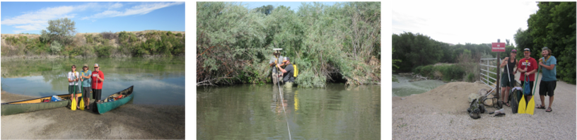
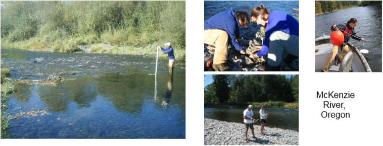
My research encompasses human-environment interactions, natural disturbances, and human land use changes within the riparian zone, with respect to river morphology, sediment transport, and ecological habitat, and regarding water resource management. An understanding of the socio-hydrological dynamics of river systems is crucial for managing river systems for all users (human, ecological, etc.), particularly in the semi-arid West and in the context of changing climatic conditions and changing land uses and goals. I focus on understanding the interactive effects of human and fluvial systems. I use a multidisciplinary suite of fluvial geomorphological and geospatial methods to examine river dynamics at different spatial and temporal scales.
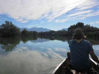
My current research focuses on two aspects of water in semi-arid lands. One of those includes projects that investigate geomorphic and sedimentological changes occurring in coastal watersheds in southern California due to land use and climate change and in southern Utah due to flash flooding. In California, I have had students conduct research in the Tijuana River Estuary and Los Peñasquitos Estuary, as well as on the San Diego River Watershed. In Utah, I collaborated on research on downstream impacts of the Jordanelle Dam on the Provo River. With colleagues, I continue a longer-term project to study the geomorphic impacts of flash floods in Capitol Reef National Park using imagery to create 3D terrain models to quantify geomorphic change.
The other aspects is one that I am still exploring and developing, and includes quantifying changes in water supply and evaluating water policies related to decreases in available water in Cape Town, South Africa, and San Diego county in southern California. One project focuses on Cape Town's Day Zero water crisis and the long-term and short-term policies enacted in response, including the social justice component of those policies. Another project relates the lessons learned in Cape Town to the declining water supply and the policies implemented in San Diego county, both projected to be under continued water stress in the future.
The applications of the tools I use in geomorphic research are expansive. Many of my GIS students have utilized their skills to engage in projects with local organizations such as Urban Corps, the New Americans Museum, and our on-campus Mulvaney Center and the Trans-Border Institute. Two students won a national GIS poster contest for their research.
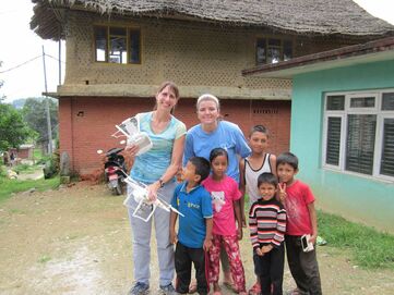
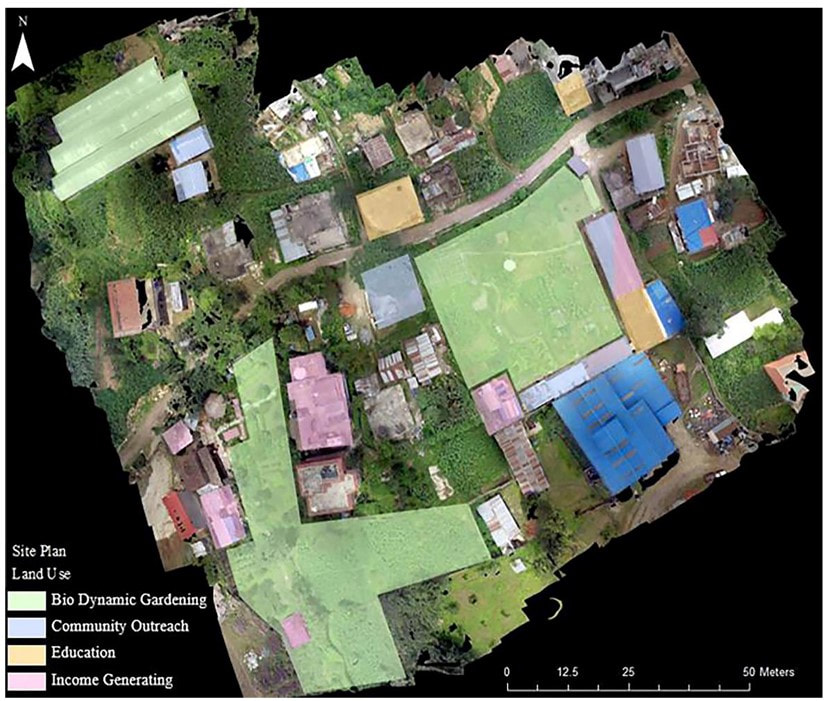
In 2016, I worked in Nepal with a student and eSAVANA colleague, Krishna Gurang, to map the Kevin Rohan Memorial Eco-Foundation (KRMEF) outreach projects and land use using GPS and a DJI quadcopter and creating an ESRI Story map of the project for the foundation.
For the past 10 years, I have been involved with the Geotech center geospatial teacher training and the iGETT project on teaching and training geopatial technologies.
My current research focuses on two aspects of water in semi-arid lands. One of those includes projects that investigate geomorphic and sedimentological changes occurring in coastal watersheds in southern California due to land use and climate change and in southern Utah due to flash flooding. In California, I have had students conduct research in the Tijuana River Estuary and Los Peñasquitos Estuary, as well as on the San Diego River Watershed. In Utah, I collaborated on research on downstream impacts of the Jordanelle Dam on the Provo River. With colleagues, I continue a longer-term project to study the geomorphic impacts of flash floods in Capitol Reef National Park using imagery to create 3D terrain models to quantify geomorphic change.
The other aspects is one that I am still exploring and developing, and includes quantifying changes in water supply and evaluating water policies related to decreases in available water in Cape Town, South Africa, and San Diego county in southern California. One project focuses on Cape Town's Day Zero water crisis and the long-term and short-term policies enacted in response, including the social justice component of those policies. Another project relates the lessons learned in Cape Town to the declining water supply and the policies implemented in San Diego county, both projected to be under continued water stress in the future.
The applications of the tools I use in geomorphic research are expansive. Many of my GIS students have utilized their skills to engage in projects with local organizations such as Urban Corps, the New Americans Museum, and our on-campus Mulvaney Center and the Trans-Border Institute. Two students won a national GIS poster contest for their research.
In 2016, I worked in Nepal with a student and eSAVANA colleague, Krishna Gurang, to map the Kevin Rohan Memorial Eco-Foundation (KRMEF) outreach projects and land use using GPS and a DJI quadcopter and creating an ESRI Story map of the project for the foundation.
For the past 10 years, I have been involved with the Geotech center geospatial teacher training and the iGETT project on teaching and training geopatial technologies.
Past projects
Karhare, outside Kathmandu, Nepal
ESRI Story map on the Kevin Rohan Eco Foundation
ESRI Story map on the Kevin Rohan Eco Foundation
Jordan River, Utah